 On the 25th day of the Corps of Discovery Expedition, Lieutenant William Clark noticed some rock paintings on a bluff that he wanted to examine. On that day, June 7, 1804, he noted in his journal, “a Short distance above the mouth of [a] Creek, is Several Courious paintings and carving on the projecting rock of Limestone inlade with white red & blue flint, of a verry good quallity.” Clark also included drawings of three of those rock carvings in his journal. That bluff was a short distance above a creek they called “Big Monetou” and we know as Moniteau Creek. Lewis & Clark had stopped in the area where the town of Rocheport, Missouri now sits.
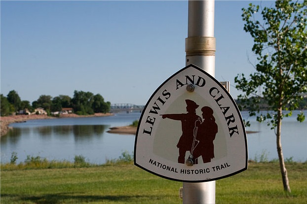
Missouri holds an important place in the expedition, as it officially started near St. Louis and ended back in that city two years, four months, and 10 days later. The names Lewis & Clark can be seen in so many places in our state that the historical significance can be difficult to appreciate. For example, Lewis & Clark’s Restaurant in St. Charles makes a mean french dip sandwich, but I’m not sure what that has to do with the expedition. On June 7, 2018, 214 years after Clark made that journal entry, you can revisit this chapter in the expedition that took place in our neck of the woods. DBRL is hosting a presentation in Rocheport by the president of the Manitou Bluffs chapter of the Lewis & Clark Heritage Trail Foundation. Afterwards, you can walk to Lewis and Clark Historical Marker #39, where Clark saw some of the rock paintings he documented. Although the petroglyphs themselves were lost in the name of progress when the railroad was built, you can still stand in the presence of history.
In the meantime, we have ample resources to explore the Lewis & Clark expedition’s path through Missouri and across the country. For an excellent overview you could watch the Ken Burns documentary, “Lewis & Clark: The Journey of the Corps of Discovery.” If that whets your appetite you could get in-depth and read “The Journals of Lewis and Clark,” a detailed record by the men themselves of the flora and fauna they sighted, the Indian tribes they encountered and the landscape they traversed.
If you’ve ever looked at the path of Lewis & Clark on a map and thought to yourself, “that would make a pretty great road trip,” there are a number of guides for you. “Lewis and Clark Road Trips: Exploring the Trail Across America” is an informative atlas designed specifically for those who want to follow the route of Lewis and Clark by car, covering more than 800 destinations in 23 states. “The Lewis & Clark Trail” is National Geographic’s bicentennial edition of their guide to the Lewis & Clark Trail, and it puts the entire route into a compelling historical context.
If you want to specifically learn about the Corps of Discovery’s time in Missouri, “Lewis and Clark in Missouri” looks at the story of the expedition through the lens of their time here. For thorough maps of their activity in our state the “Atlas of Lewis & Clark in Missouri” is an intensive examination of the Missouri portion of the expedition through a series of 27 maps. They were developed by combining early 19th century U.S. General Land Office survey documents with narratives of the trip derived from expedition journals. Finally, if you want to get out and explore their path through Missouri yourself, “Follow the Lewis & Clark Trail in Missouri” is a guide that identifies locations along the Missouri and Mississippi Rivers that were documented in the journals and that can be visited today.
Join us for Lewis & Clark in Rocheport on June 7 from 6:30- 8 p.m. at the Rocheport Community Hall to learn more!
Image credit: Keith Gurstung, Lewis and Clark via Wikimedia Commons (license)


